-
E-mail
2850187703@qq.com
-
Phone
18319055480
-
Address
B3, 4th Floor, Jiale Building, No. 47 Zhenhua Road, Futian District, Shenzhen, Guangdong Province
Product Categories
Shenzhen Pengjin Technology Co., Ltd



Obstacle avoidance drone quotation
NegotiableUpdate on 01/17
- Model
- Nature of the Manufacturer
- Producers
- Product Category
- Place of Origin
Overview
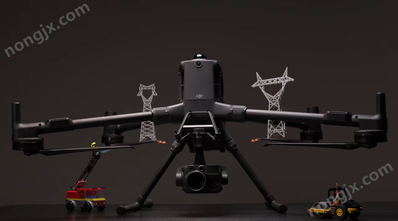
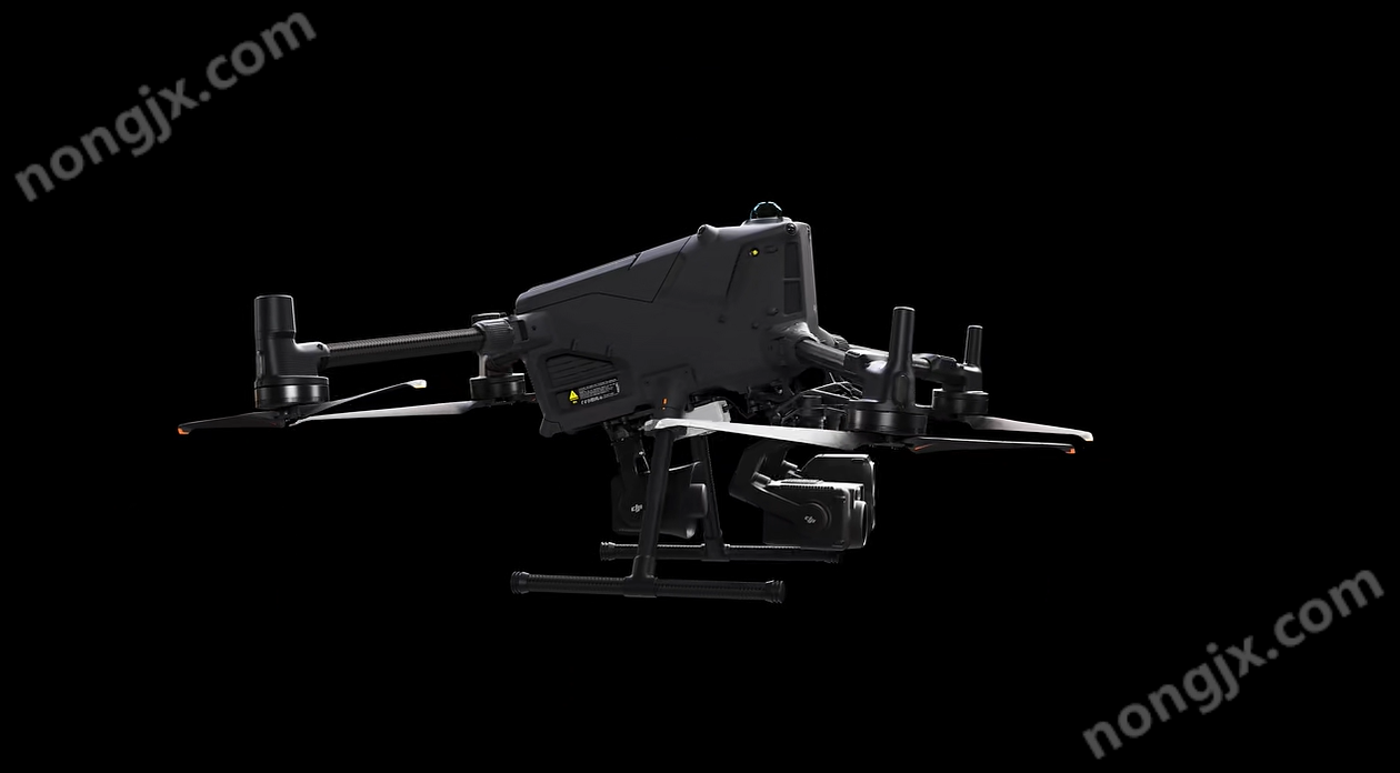
DJI/DJI M400 small multi rotor wire level obstacle avoidance drone, Matrice 400 can carry up to 6 kilograms and has a super long endurance of 59 minutes, which can achieve wire level obstacle avoidance with a maximum image transmission distance of 40 kilometers.
Product Details
The Matrice 400 can carry up to 6 kilograms and has a super long endurance of 59 minutes. It can achieve wire level obstacle avoidance and has a maximum image transmission distance of 40 kilometers. Supporting new functions such as thermal imaging model detection, simulated wire winding and crossing, automatic inspection of grounding wires, and ship takeoff and landing, it stands out in emergency rescue, power inspection, surveying and other scenarios.
Long endurance, flying fast
Matrice 400 has a long battery life and is a reliable helper for long-term continuous operations such as search and rescue, firefighting, and large-scale surveying. It can also avoid large objects such as buildings and mountains at a flight speed of up to 25 meters per second.
Forward flight endurance |
hover time |
59 minutes |
53 minutes |
Multiple loads, multiple scenarios
Matrice400 has strong load capacity, with 4 external E-Port V2 interfaces on the body, capable of carrying up to 7 loads and a maximum load capacity of 6 kilograms; It can freely switch between a single gimbal and a dual gimbal, and supports the third gimbal component on the belly of the machine.
Facing different tasks, Matrice 400 can be equipped with DJI gimbal cameras, searchlights, speakers, MiaoSuan3 or third-party load devices, expanding its capabilities and fully unleashing the potential of the DJI ecosystem.
According to the load configuration, the flight time of Matrice 400 is as follows:
Clever Calculation 3 |
Zenith H30 series |
Zen Thinking L2 |
Zen Thinking P1 |
Zenith S1 |
Zenith V1[ |
A high-performance onboard computing power box that packs 100 TOPS of surging computing power into a lightweight body weighing only 120 grams. |
The all-weather multi light flagship load Zenith H30 series integrates five major modules, breaking through the limitations of day and night vision. |
The airborne high-precision mapping LiDAR Zenith L2 has precise, efficient, and reliable 3D data acquisition capabilities. |
Zenith P1 integrates a full frame image sensor and a three-axis gimbal, providing a high-precision, high-efficiency, and integrated aerial surveying solution. |
Zenith S1 is a large-scale unmanned aerial vehicle searchlight payload in the DJI Shou industry, with high brightness and long illumination distance. |
Zenith V1 is a large-scale unmanned aerial vehicle (UAV) loudspeaker payload in the DJI Shou industry, with high volume and long transmission distance. |
Safe and reliable, flying with peace of mind
Wire level obstacle avoidance
The powerful obstacle avoidance system composed of ring scanning lidar, high-precision millimeter wave radar, and full-color low light fisheye vision sensor elevates the Matrice 400's obstacle avoidance capability to a whole new level.
It can detect small obstacles, avoid high-voltage lines crossing mountains at night, and perceive the surrounding environment through rain and fog, ensuring safe operations 24/7.
image transmission
O4 Image Transmission Industry Enhanced Edition |
Image transmission relay |
|
The Matrice 400's maximum distance for remote image transmission is 40 kilometers. Matrice 400 supports the sub-2G frequency band and can also install 2 DJI enhanced image transmission modules, automatically switching to a better quality operator network for more stable signals. |
Matrice 400 has a built-in image transmission relay module. Operators can raise one drone as a relay to provide relay signals for another drone, greatly expanding the operating range in heavily obstructed environments such as mountainous areas. |
fusion positioning
The fine omnidirectional sensing performance brought by visual sensors, millimeter wave radar, and ring scanning lidar enables the Matrice 400 to have powerful positioning capabilities.
It can fly stably close to glass buildings or wind turbine blades, and can also safely return from scenes such as building edges, mountain foothills, and bridge edges before refreshing the return point.
Full color flight assistance image
The four full-color low light fisheye vision sensors on the fuselage can provide color flight assistance images, making flying more reassuring.
Fearless of rain, snow, cold, and heat
Matrice 400 is not afraid of extreme cold and heat, and has waterproof and dustproof capabilities. It can still operate normally in harsh environments such as dense sand and dust or rain splashes.
Protection level |
Operating Temperature |
IP55[15] |
-20 ℃ to 50 ℃ |
Super intelligent, high efficiency
Intelligent Detection
Matrice 400 can detect and count targets such as cars and ships through visible light and thermal imaging cameras, and supports switching to third-party object detection models to expand more application scenarios.
It also supports ultra clear matrix detection, which can detect up to 1000 targets on a single photo, easily achieving large-scale target detection, statistics, and density analysis; More powerful tracking function, allowing for flexible switching of tracking targets between multiple targets.
Intelligent AR Projection
Wire AR |
Map AR |
AR flight trajectory |
Point line surface drawing |
The obstacle avoidance system will automatically detect electrical obstacles in front of the drone and project them onto the remote control screen with easily recognizable AR lines, making the surrounding environment clear and the flight safer. |
No matter in the day or at night, the remote control can display the names of buildings, landmarks, etc. in real time on the screen, and mark the core road with conspicuous lines. |
Real time display of drone route planning during return, obstacle avoidance, and flight towards the target point; During landing, the drone's near ground projection can also be displayed to help operators confirm the target landing location. |
You can directly click on the remote control to obtain the position, draw lines to calculate the distance, and draw surfaces to calculate the area. The measurement results can be synchronized to Sikong 2, making team collaboration more efficient. |
Real time ground simulation
Matrice 400 supports real-time ground simulation flight in any horizontal direction, which can be enabled during manual flight and route operations to maintain relative height stability to the ground.
During large-scale search and rescue operations, the size of ground targets on the remote control screen can be kept consistent, reducing zoom operations and improving search and rescue efficiency; During surveying and mapping operations, it can ensure consistent ground resolution and obtain high-precision mapping data.
Take off and land on board
In response to the needs of offshore wind turbine inspections, maritime inspections, and other water operations, Matrice 400 has added a ship takeoff and landing function, supporting static ship takeoff and dynamic ship landing, and recognizing the landing point patterns on the ship's hull for safe landing.
Intelligent flying
constant speed |
Fly towards |
track |
surround |
By activating the constant speed mode, the drone can be controlled to fly continuously in a designated direction without the need for continuous pole strikes, making long-distance flights more effortless. |
In emergency or disaster situations, after selecting the target location, the drone can automatically adjust its flight path and speed according to the surrounding environment and fly towards the target location without manual intervention. |
After selecting the target object, it can be continuously tracked and supports precise target positioning and automatic adjustment of magnification. It can also easily switch tracking targets, and even if the target is briefly lost, it can be automatically retrieved. |
Support flying around the target area, suitable for continuous observation of risk areas and three-dimensional modeling of buildings, greatly improving the efficiency of fixed-point observation and modeling. |
Easier automated tasks
H30 series ground wire automatic inspection
When equipped with the H30 series gimbal camera, the Matrice 400 can use the top body LiDAR to detect and lock onto the target ground wire, while maintaining a distance between the body and the ground wire. It can fly sideways at a set speed and continuously take photos of the wires. Efficient and safe automated ground wire inspection can be easily achieved without the need for advanced control skills.
L2 power grid simulation flight
When equipped with L2 laser radar, Matrice 400 can achieve simulated flight of transmission and distribution lines, and can use the built-in ring scanning laser radar on the aircraft to sense obstacles in real time. When encountering cross lines, it automatically detours and easily collects line data.
Slopes, geometric flight paths
Matrice 400 supports the planning and execution of inclined and geometric routes through DJI Pilot 2 or DJI Sikong 2, efficiently obtaining high-precision data.
DJI/DJI M400 Small Multi rotor Wire level Obstacle Avoidance Drone
DJI/DJI M400 Small Multi rotor Wire level Obstacle Avoidance Drone


